Since 2016, we have been at the forefront of drone technology for inspecting roofs and performing site surveys. As a software company, we have supported and analyzed various drones in the market. This brings up an important question: Does drone hardware really matter?
The answer is a definite yes. However, it is important to understand that neither hardware nor software alone can provide a complete solution. They must seamlessly integrate with each other to serve specific purposes, like inspecting and measuring roofs.
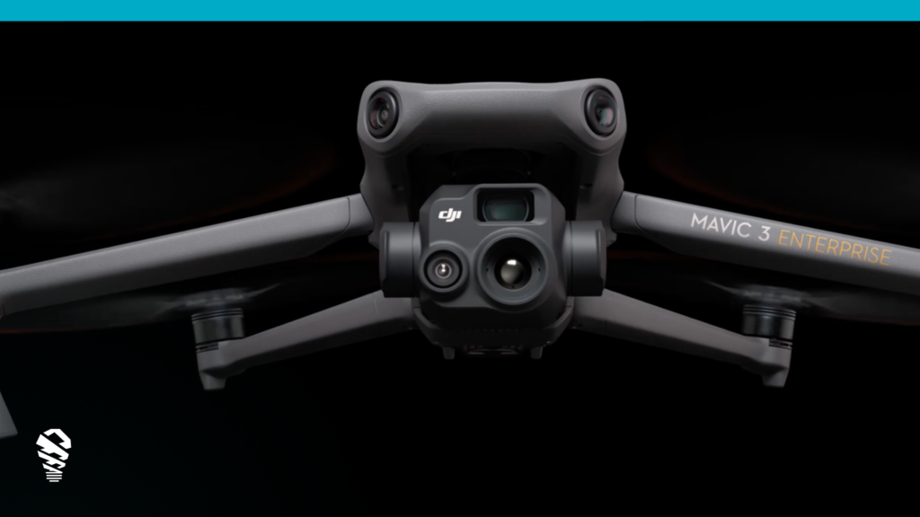
In this article, we will delve into a crucial feature that sets enterprise-grade inspection drones apart from the rest: the mechanical shutter. We will focus on Loveland Innovations’ IMGING platform and specifically highlight DJI’s Mavic 3 Enterprise (M3E), which incorporates a mechanical shutter. This advancement enhances image quality compared to previous Mavic 2 models, and we will explore its significance in detail.
Understanding the Mechanical Shutter:
To understand why mechanical shutters are so important, let us compare them to other types of shutters used in cameras. There are electronic shutters and rolling shutters, but mechanical shutters work differently. Instead of relying on electronic signals or a rolling mechanism, they use physical parts to control how long the camera’s sensor is exposed to light and the differences in how they do so can result in a difference in image quality.

Electronic shutters work differently than mechanical shutters. Instead of exposing all pixels simultaneously, electronic shutters expose the image sensor one line of pixels at a time. This gradual exposure from top to bottom can cause a slight time delay between the top and bottom of the frame. While this delay is usually not noticeable, it can create a rolling or jello effect when capturing moving subjects or when the camera itself is in high-speed motion, such as during a drone flight. In contrast, mechanical shutters expose all pixels simultaneously. Understanding mechanical shutters helps us appreciate the superior benefits they offer in terms of image quality.
The Mavic 3 Enterprise: Elevating Inspecting Precision:
The Mavic 3 Enterprise (M3E) is an advanced drone used by surveying professionals to elevate the precision of their work. It is incorporated into Loveland Innovations’ IMGING platform, which is a powerful tool for conducting inspections. One of the key features of the M3E is its compact and portable design, making it easy to transport and operate in various locations.
The M3E is equipped with a 20-megapixel wide camera that has a 4/3 CMOS sensor. This high-quality camera allows surveyors to capture detailed images with exceptional clarity and sharpness. But what sets the M3E apart is its mechanical shutter. This specialized mechanism helps ensure precise capture of images by controlling the exposure time accurately.
As a result, professionals using the M3E can achieve unmatched inspections, maintain high accuracy in their survey data, and complete their work with greater efficiency. Its compact and portable design, along with its 20MP wide camera and mechanical shutter, enables surveyors to conduct precise and efficient inspections, enhancing the overall quality and accuracy of their work.
Enhanced Image Capture Rate:
The Mavic 3 Enterprise (M3E) drone boasts an impressive feature called the enhanced image capture rate. This means that it can capture images at an incredibly fast speed of just 0.7 seconds between each shot. This rapid image capture rate brings several advantages for surveying professionals. One significant benefit is the reduction in the time it takes to complete a roof inspection. With shorter intervals between shots, the M3E enables surveyors to cover larger areas in less time compared to other drones or traditional surveying methods.
The faster image capture rate of the M3E translates to increased productivity. Pilots can collect data more efficiently, as they spend less time waiting for the drone to capture images. This improved efficiency allows professionals to complete their inspections quickly, enabling them to move on to other tasks or projects sooner.
The enhanced image capture rate of the M3E is a game-changer for professionals who need to cover vast areas swiftly and effectively, providing them with a valuable tool to streamline their data collection processes. It reduces the survey duration, enabling quicker coverage of larger areas. This increased efficiency in data collection boosts productivity, allowing professionals to accomplish their surveying tasks more effectively and saving valuable time.
Improved Low-Light Capabilities:
The Mavic 3 Enterprise (M3E) drone comes with an exciting feature called improved low-light capabilities. The wide camera of the M3E not only captures impressive 20-megapixel resolution images but also incorporates special 3.3μm pixels and enhanced low-light software. These advancements allow the drone to excel even in dim lighting conditions, expanding the operational window for professionals.
With the M3E’s improved low-light capabilities, inspections can be conducted in challenging lighting environments without sacrificing image quality. This means that surveyors can now gather valuable data in situations where it would have been difficult before. Whether it is early morning or late evening, or when natural lighting conditions are less optimal, the M3E ensures that professionals can still capture clear and detailed images. This versatility in operating under low-light conditions enhances the drone’s usefulness and allows surveyors to complete their work more effectively, regardless of the lighting challenges they may encounter.
Mitigating Distortions and Ensuring Accuracy:
A mechanical shutter helps mitigate distortions that can occur with other types of shutters, such as rolling shutters. Distortions can make images look wobbly or stretched, and they can affect the accuracy of the data collected. However, with a mechanical shutter, these distortions are eliminated, ensuring that the images captured are clear, accurate, and free from any unwanted distortions.
By using a drone with a mechanical shutter, professionals can produce precise inspections and gather accurate data for analysis and decision-making. The images obtained are reliable and represent the actual conditions being inspected, without any visual distortions. This allows for more accurate measurements and inspections, which are essential for in-depth data analysis and reporting. By mitigating distortions and ensuring accuracy, the use of a drone with a mechanical shutter enhances the overall data quality of inspections.

The hardware components of a drone play a significant role in elevating the quality and precision of inspections. The integration of a mechanical shutter in drones, such as the Mavic 3 Enterprise, ensures accurate image capture by eliminating distortions caused by rolling shutters. This key feature results in clear, sharp, and artifact-free images, allowing professionals to conduct precise inspections and collect accurate data for analysis and decision-making.
Furthermore, the M3E’s compact design, 20-megapixel wide camera, and enhanced image capture rate of 0.7 seconds between shots enhance insepction efficiency and productivity. The drone’s improved low-light capabilities further expand the operational window for professionals, enabling inspections in challenging lighting conditions without compromising image quality.
The combination of the Mavic 3 Enterprise drone and IMGING software by Loveland Innovations revolutionizes the field of drone roof inspections. By utilizing a drone with a mechanical shutter and advanced features like those found in the Mavic 3 Enterprise, in combination with the powerful capabilities of IMGING, professionals can confidently conduct inspections with exceptional precision and reliability. This seamless integration of hardware and software ensures the capture of high-quality, accurate data, leading to the production of detailed and reliable reports. Professionals can achieve enhanced accuracy, efficiency, and excellence in aerial inspections.


