How SUNation Energy Cut Survey and Design Times in Half
Watch how leading New York – area solar provider SUNation Energy cut survey and design times in half with IMGING by Loveland Innovations. https://vimeo.com/834219325


Watch how leading New York – area solar provider SUNation Energy cut survey and design times in half with IMGING by Loveland Innovations. https://vimeo.com/834219325

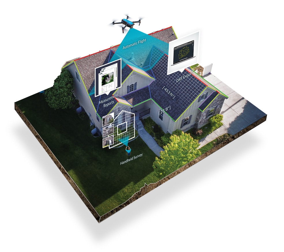
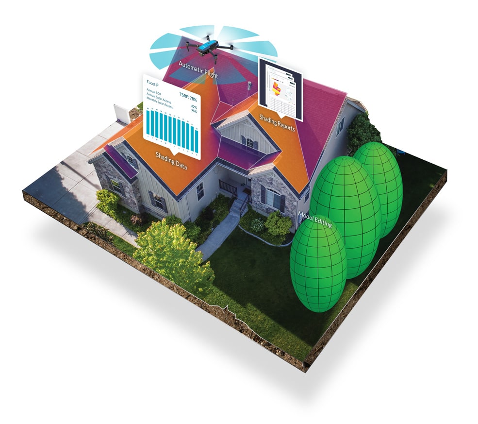
Solar site surveys are an essential part of the solar installation process. They allow solar installers to assess a property’s suitability for solar panel installation

Are you a site surveyor or manager considering adopting drone technology for site surveys? If so, this article is for you. The number one reason